The Saint-Lawrence Lowlands
Located in the western part of the Brome-Missisquoi territory, bordered by the Saint-Lawrence lowlands, the Pike River and Yamaska Plains with their vast open spaces, constitute one of the five great landscapes of the region.

Open Farmland Landscapes
Marked by the passage of glaciers and the Champlain Sea, these wide expanses of land lead us across a decor which, today, is greatly immersed in an intensive agricultural landscape. From Farnham to Pike River by way of Notre-Dame-de-Stanbridge, corn and soya have become the primary crops along these long, very straight country roads, where dairy, porcine and poultry producers have also established their farms.
Characterized by a development under the Canadian Seigneurial System (1623–1854), this part of the territory, spread around the Pike river, is tied both visually and culturally to the neighbouring MRCs of Haut-Richelieu, Rouville and Des Maskoutains.

A Soil Marked by the Weight of Ancient Glaciers
Under the weight of the last glaciers, the soil composing the Earth’s crust collapsed. This is how, 12,000 years ago, the Champlain Sea settled here in these plains all the way to the Appalachian Piedmont.
It would take 2,000 years for the sea to recede, which brought about a depot of clay and sand sediments, characteristic of the Saint-Lawrence lowlands very rich soil. In fact, this gradual receding created the white sand beaches we can find in the Bedford and Farnham regions. The Rang Saint-Henri and Route 235 are set alongside this sandy hill.

Over 2,000 Years of Agriculture
The plains of the Brome-Missisquoi territory have been suitable for agriculture for a very long time. Although we find little evidence of this, some archeological digs have proven that this way of life has shaped Brome Missisquoi for more than 2,500 years.
According to what we presently know, it’s more than probable that a navigation network, along with land portages, promoted territorial communications between First Nation tribes. Different studies have led us to believe that these plains were often used as camps, or even aboriginal villages, surrounded by corn and squash crops in warmer seasons. In fact, it seems quite clear that at least one Iroquois camp was established by the first falls of the Rivière aux Brochets, between the Towns of Pike River and Notre-Dame-de-Stanbridge.

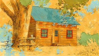
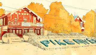
Aging Towns
The business centre of the Yamaska Plain, the city of Farnham, benefitted from hydro power provided by the Yamaska River for its expansion. Thanks to this resource, until the beginning of the 20th century, the town was known as one of the most important industrial centres of the MRC. Still today, working-class neighbourhoods surround this growing institutional core.
More to the south, in the Pike River Plain, towns such as Notre-Dame-de-Stanbridge, Pike River and Stanbridge Station are experiencing another fate. For several decades, these communities have stopped their expansion. Indeed, the intensification of agriculture, rural exodus and a decrease in the number of children per family have caused the population to stagnate. In fact, the area’s aging population promises to be a major demographic challenge for the Pike River Plain region.

The Struggle With Cyanobacteria
Defining the Pike River Plain includes the passage of the Champlain Sea, of which Missisquoi Bay remains an imprint of its ancient presence. One of the tributaries of this bay, the Rivière aux Brochets, contributed greatly to the development of the local landscape of the region. This is why its name until 1968, was the inspiration for calling this area the Pike River Plain.
However, intensification of agriculture throughout the 20th century, has taken its toll on the waterway system that flows into Missisquoi Bay. Over the last few years, the bay has become Quebec’s emblem for the fight against Cyanobacteria. Initiatives geared at improving agricultural practices, as well as the creation and maintenance of riparian strips are among the reasons why this waterway management is cited as a model. Projects such as these have created new landscapes for this intensive agricultural setting.